Thursday, February 21, 2013

Ushuaia, Argentina


The first thing to learn about Ushuaia is how to pronounce its name, which is much easier than it looks…oo-shoo-AYE-ah.  It is a Yahgan Indian word meaning “a bay penetrating westward.”  It was born a mission town, then became an Argentine naval base, then a convict settlement, and today is a busy city of about 80,000 people that rightly claims to be the southernmost city on earth.

 
The city is the main jumping-off point for tourists and international scientists heading for Antarctica.  A group of 33 people left the ship for their flight to Antarctica today (it was a spendy tour, like $1000 or so per person someone said).  There’s always the possibility that they can’t even land.

 
We had a private tour today for just 4 of us (our neighbors from Colorado were with us).  We arranged for a taxi/tour guide through a recommendation from Tripadvisor.com.  We expected to be able to walk off the ship as soon as it was cleared through immigration.  But the Captain came on the speaker and said the Pilot captain said no way would this ship be able to dock due to tides or something….we would have to tender in.  Well, nobody, including the crew was prepared for this so instead of meeting our guide shortly after 7 am, we finally connected with him around 8:30 am.  Then off we went.


View of Ushuaia from the ship

 
Ushuaia is in a beautiful setting overlooking the Beagle Channel, named for the ship that carried Charles Darwin on his voyage of discovery in 1831-36.  The backdrop of snow-capped, densely forested peaks was stunning with the morning sun on them. 


Many of the houses are wood with gingerbread decorations.  They lend a vaguely Russian appearance to the town that many say reminds them of Sitka, Alaska.


Our driver, Charlie, headed for Hidden Lake and Fagnano Lake for the morning portion of our tour.
Chairlifts on the southernmost Ski Hill


Then we headed to the Tierra Del Fuego National Park, which again resembles the terrain of the Alaskan panhandle.  The park and the panhandle lie at about the same latitude (about 55 degrees North and South) and in many respects are mirror images of one another.  The weather is rainy and foggy for most of the year and has created dense rainforests that grow to the edge of the sea. Glaciers are common and fiords are deep and long and rugged mountains jut up several thousand feet directly from the sea.

The end of the PanAmerican Highway


The end of the PanAmerican Highway is in the park at the end of a narrow, dirt road.  Of course we had to have our picture taken by the sign marking the end.  It’s only about 18,000 km from Alaska!

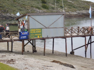
The post office at the end of the world!
 

This certainly was a beautiful day around the southernmost city on earth.


Wednesday, February 20, 2013

Cape Horn


Here are a few facts about Cape Horn. It is really a tiny island, not on the mainland as one might expect. The name Cape Horn came from a city by the name of Hoorn in the Netherlands.
Cape Horn

Cape Horn marks the northern boundary of the Drake Passage, and was used as a milestone for the clipper ships which carried the trade from around the world. It is treeless, but green, due to frequent rain. It is a treacherous area, infamous for shipwrecks. Until 1914, when the Panama Canal was completed, it was the only way to get around South America by sea. The Chilean Navy maintains a station that consists of a residence, utility building, a chapel, and a lighthouse.

 
People on deck to view Cape Horn


We are at the bottom of the world!

The memorial is that little speck on top of hill in middle of photo

A memorial depicting an albatross, erected in 1992, honors the sailors who died rounding this cape. We could barely see the albatross statue.  Binoculars helped butmy camera could only pick up a speck.  The inscription on the memorial reads:

 
I am the albatross that awaits for you at the end of the world. I am the forgotten soul of the sailors lost that crossed Cape Horn from all the seas of the world. But die they did not in the fierce waves, but today towards eternity in my wings they soar in the last crevice of the Antarctic winds. (Sara Vial Dec. 1992)

 
The ship slowly sailed around the island of Cape Horn for plenty of photo opportunities before heading to our next port, Ushuaia, Argentina.

Tuesday, February 19, 2013

A change in itinerary...

"Rough mounting seas"


Detouring away from Falkland Islands

Today we were supposed to be at Port Stanley, Falkland Islands.  However, last evening the Captain came on the speaker system and explained that due to an approaching storm in that area and increased winds, we were changing course and skipping the Falkland Islands port.  This really wasn’t a surprise as ships actually get to the Falklands only about 50 percent of the time.  This just wasn’t our time.  The port is a tender port, which means that the ship anchors off shore and passengers are transported to land via small boats.  This particular tender port can be quite dangerous for the tenders as the ship anchors about 3 miles off shore and it’s a 30 minute ride in the tender.  With rough seas, this could be a dangerous ride.


So, instead the ship altered course and we head for Cape Horn.  This should give us additional scenic cruising time as we round the cape tomorrow.  We are still in seas that are a bit rough, but not too bad.  As we head east and south, the seas seem to become calmer.  We spent the day reading books on our Kindles and went to see the movie Argo this afternoon.  Today is also our half-way point on this cruise as far as days go.

 
Tomorrow we will ‘round the horn’.

Monday, February 18, 2013

Puerto Madryn, Argentina


About halfway between Buenos Aires and Cape Horn along the Atlantic coast, our ship negotiated the narrow entrance to Golfo Nuevo and docked at the city of Puerto Madryn.  The city itself is of only moderate interest, but it is the jumping-off point for two of the most spectacular wildlife settings in the world:  Pennisula Valdes and Punta Tomba.

Our tour for the day was to Punta Tomba, located 100 miles south of Puerto Madryn and the site of the largest Magallenic penguin rookery in the world. 

We dressed for cooler weather today.  Temps in the low 60’s with wind.  So we dug out our jeans and windbreakers and were set to go.  It was a 2.5 hour drive to the penguin reserve.  The landscape looked very much like Wyoming to us.


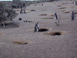
We arrived at Punta Tomba and started our hike down the path toward the ocean.  Hundreds of thousands of penquins and a variety of birds migrate to this area every year from September to April.  The penguins court, mate, and hatch a brood of chicks and are ready to migrate to warmer climates in Uruguay and Brazil by April.


There were penguins everywhere you looked, as far as you could see.  As I was unable to gather them together for a group photo, I just photographed a few of them.  There was a constant stream of penguins going back and forth between the nests and the sea.  These are Magellenic penquins, also called Jackass penguins because they sound just like a donkey braying.


A Llama seen from the bus
 

It was an interesting day.  We’ll be seeing more penguins over the next few days.  Leaving Puerto Madryn, we now sail toward the Falkland Islands, where the weather will be cooler and the seas a little bumpy.

Sunday, February 17, 2013

Montevideo, Uruguay


We were delayed about 2 hours leaving the dock in Buenos Aires.  We sailed down the river overnight and in the morning the Captain announced that we would be 2 hours late in arriving in Montevideo!  Something about high winds (??).  Well, we probably won’t ever know what caused the delay.  We do know that Montevideo is only a 3-hour ferry ride from Buenos Aires. It took the ship 12 hours.

As we sailed into the harbor, we noticed a ship’s junk yard or perhaps graveyard.  Guess they don’t sink them here, just shove them aside.


We had a tour booked with 14 others from our Cruise Critic roll call.  It included a bus ride through the city and then a wine tasting at a winery just outside the city. 
 
This was the first time we had a bus (16 pax) that the AC didn’t work very well.  Not only did it not cool much, every time the bus turned a corner the passengers in the back row got AC water dripped on them.  Taking photos from a bus window doesn’t provide very good pictures, but I got some and we did stop and get out of the bus a couple of times.  The city is clean with beautiful homes and business buildings.  Uruguay is called the “Switzerland of South America” primarily because of its small size, its high standard of living, and its extraordinary democratic institutions.


The whole coastline is lined with beaches.  Now this is where the river flows into the ocean.  The river water is dirty as it comes from the rain forests and with it mud.  You could really see the point in the water where the ocean water met the river water.  There definitely was a line, but not noticeable in photos.  Buenos Aires had no beaches.  No one would want to go in that water anyway.  But Montevideo was filled with beaches; those near the downtown are not recommended for swimming but those east of the town are less polluted. The river is 250 km wide at Montevideo, which makes it the widest river in the world.


Our first stop was at a monument that represents something about sea monsters.  Our tour guide was a very nice young lady, but she had quite an accent and it was hard to understand her words at times.


An interesting statue was at the Korean Embassy building.  It is of a Korean man bowing down, with his eyes looking toward Korea.
The Korean statue....photo on its side!


The Legislative Palace is considered one of the most beautiful legislative buildings in the world.


The LaCarreta Monument depicts a cattlewagon statue, which may be a tribute to the gauchos—the cowboys of the 18th century.  I’m not sure as I couldn’t understand the guide.
 

After the city tour we headed to the Bouza Winery just outside of Montevideo.  It was a charming winery.  We enjoyed a wine tasting with cheese and breads.


Terry enjoying checking out an old John Deere tractor.  Brings back memories for him of growing up on a farm.


Back on the ship we left port during our dinner hour.  This was the first time we have not been on deck to watch the ship sail away from the harbor.  Wish we would have been on deck to see what happened as all of a sudden the ship tipped to starboard (right side in nautical talk) and from the dining room windows we could see the water rise up to window level.  Then the dishes started falling in the kitchen area and we heard crashes and clanking and people yelling out “Oh, no!, etc.”  This lasted only seconds but it was a bit unsettling.  When we returned to our stateroom, our cabin attendant said he was up on deck and saw a cargo ship coming toward our ship’s lane and it was way too close.  Our ship did a sharp turn to avoid the cargo ship.  We never did hear any announcement from the Captain about this. 


But we left the harbor safe and headed to our next port, Puerto Madryn, Argentina where we will see our first penguins of the trip.  I noticed during our day in Uruguay that my hair did not frizz for the first time since leaving Colorado.  The humidity must be going down, the temps are also a bit cooler, and the days are getting longer as we head down toward the bottom of South America.

Saturday, February 16, 2013

Buenos Aires


Valentine’s Day and we were up and out of our hotel by 7:30 am to fly from Iguazu to Buenos Aires, where we hoped our ship would be at port.  Argentina can make things very unpleasant for cruise ships that choose to have the Falkland Islands on the itinerary due to the political issues with Great Britain.  There had been no problems during the last few weeks so we hoped for the best. 

We left Iguazu with rain still coming down and arrived in sunshine in Buenos Aires where our guide, Luis, was waiting for us.

 Buenos Aires (which roughly translated means “fresh air”) was founded originally in 1536, but the Spaniards sent to colonize the mouth of the Rio de la Plata River were forced away by the native population.  A second more successful attempt was made in 1580.  It wasn’t until the early 1800’s that the city and then the country emancipated itself from the Spanish crown and became the Republic of Argentina.

 
Argentina sits at the mouth of the river and has a population of over 12 million.  It is a beautiful city, full of parks, beautiful architecture, and is very clean. The population is a melting pot of European and South American cultures, with over half of the citizens being of Italian descent.

 
Our plan was to get a little siteseeing tour in before heading over to the ship, which would be leaving early evening.  So off we went under the guidance of Luis to check out this beautiful city in about 4 hours.


Our first stop was in the Palmero district, with lakes, botanical gardens, and walkways.  The streets are lined with huge trees offering much appreciated shade.


Next was the Recoleta district.  This is the city’s high class neighborhood.  It grew up around the Recoleta Cemetary, where the ancestors of the city’s aristocracy are buried.  Begun in 1822, this amazing cemetery is a virtual crypt city of tall and elaborate tombs and mausoleums covering about 4 square blocks.  The most visited mausoleum is the tomb of Eva Peron, the wife of former President Juan Peron. She was the rags-to-riches legend who was responsible for bringing women out of the dark ages, and given a voice to better themselves. She died at the young age of 33, even though some of Argentina's elite resented her, she was loved by many. Surprisingly, her family crypt was very conservative in this revered cemetary.


Leaving Recoleta we drove to the Plaza de Mayo, which is the historic center that includes the Metropolitan Cathedral, dating back to the 18th century, and the Casa Rosada, the pink palace where Eva Peron addressed adoring crowds from the balcony. (Think of the song, “I Cry for You, Argentina!)


Next up was the La Boca district where many of the city’s first Italian immigrants settled building corrugated iron houses on cobblestone streets. The tango is said to have been born here.  Now it is home to many artists, who have painted the metal houses in bright reds, yellows, blues and greens.


Caminito, a multi-hued pedestrian walkway, was filled with artists and craftsmen and outdoor restaurants.  There were couples on the corners dressed and ready to tango or have their picture taken for a few pesos.


We finished our day with a drive through Puerto Madera.  A neighborhood that was totally redesigned in the 1990’s.  It’s a residential area very close to the river and adjoins the downtown area with its beautiful modern office buildings.


Then it was back to the ship to reboard.  The port area is huge and was very, very busy with many cruise ships in port that day.   It is a working container port so we had to board a shuttle bus to the ship, which was 2 or 3 miles away from the entrance to the port.  It was good to get back on the ship after some very busy days of siteseeing. 


Next port is just down the river, where it meets the Atlantic Ocean—Montevideo Uruguay.  A 30-minute ferry ride from Buenos Aires or…( well, stay tuned).

Iguazu Falls

A professional photo

One of the world's great natural wonders is located on the borders of Argentina and Brazil, near Paraguay. In 2010 it was named as one of the Seven Wonders of the Modern World.  When Eleanor Roosevelt saw the falls, she exclaimed, “Poor Niagara”.  They are indeed spectacular.

 
The tropical rain forest provides the ideal setting for the torrents of water that fall and crash with a thunderous noise onto the rocks below, sending spray shooting back into the air to make beautiful rainbows. The Rio Iguassu, a tributary of the Parana, widens to a distance of two miles just above the precipice over which the river drops almost 200 feet, to create Iguassu Falls.

 The falls were discovered by conquistador Alvar Nunez Cabeza de Vaca in 1541. Its name comes from the Guarani Indian expression for "big water".


We left the ship on Monday, February 11 and flew to the Brazilian side of Iguazu.  There we were met by Alberto, our driver and kind of guide.  His English was limited, but our group leader, Penny, is fluent in Spanish and between them we were able to communicate quite well.  After checking into our hotel, Alberto took us to the Three Frontiers.  Two rivers meet here and form the borders of Brazil, Argentina, and Paraguay.


The next morning, we met our guide for the day, Diego.  He guided us through the Argentina side of the falls.  After entering the National Park, we took a train to different locations where we could walk on platforms out to the falls.  The weather was perfect for photos and the spray from the falls cooled us off as the temperature and humidity were quite high.


Argentina side
 
There were 8 of us in our little tour group:  Penny & Marilyn from California, Jenny and Graeme from Brisbane Australia, Jean and Lourdes from Montreal, Canada, and us.  There was a little bit of a language barrier with the couple from Montreal as their primary language is French, but Penny can speak French also, so she was able to help out at times.  We enjoyed a lot of laughs with everyone.

 
The Aussies and us decided to take a boat trip on the river.  We stripped down to our swimsuits, donned a lifejacket and headed up the river to the falls for an entirely different perspective of the falls.  Several times the boat was steered to go right under the falls and we got drenched!  There was a videographer aboard who filmed the entire trip….we bought the DVD but haven’t watched it yet.  The ride on the river was a blast.
After the boat ride under the falls with our Aussie friends


The next day we had a new guide, Sebastian, for the Brazilian side of the falls.  So back over the border we went, each time having to go through customs.  We stopped at a bird sanctuary where we could see many of the 450 species of colorful birds that live in the rain forests of Brazil. 
 
Toucan
 
While there, the skies opened up and it started to pour rain.  This area gets over 11 feet of rain each year.  This helps keep the falls flowing, I’m sure.  We donned our rain ponchos (a requisite for this trip) and continued on.  After entering the National Park, we boarded a bus and headed to the viewpoint for the falls.  The Brazil side offers more of a panorama of the falls.  We enjoyed every minute in spite of the rain pouring down. 
 

Brazilian side up close
 
For a late lunch we stopped at a local Brazilian restaurant where we enjoyed a buffet lunch with lots of local dishes.  The meats were served by waiters coming to the table with roasted meat on a skewer.  They carved several varieties of meat, and it was all delicious.  Terry got to pretend he was doing some carving for a photo op.

 
We are so glad that we took this side trip to Iguazu Falls.  We had a great time and made a few new friends along the way.  Our guides were excellent and all the travel went smoothly.

On February 14, we packed up and flew to Buenos Aires, where we reboarded the ship.