The first thing to learn about
Ushuaia is how to pronounce its name, which is much easier than it looks…oo-shoo-AYE-ah. It is a Yahgan Indian word meaning “a bay
penetrating westward.” It was born a
mission town, then became an Argentine naval base, then a convict settlement,
and today is a busy city of about 80,000 people that rightly claims to be the
southernmost city on earth.
 |
| View of Ushuaia from the ship |

Many of the houses are wood
with gingerbread decorations. They lend
a vaguely Russian appearance to the town that many say reminds them of Sitka,
Alaska.

Our driver, Charlie, headed for
Hidden Lake and Fagnano Lake for the morning portion of our tour.
 |
| Chairlifts on the southernmost Ski Hill |


Then we headed to the Tierra
Del Fuego National Park, which again resembles the terrain of the Alaskan
panhandle. The park and the panhandle
lie at about the same latitude (about 55 degrees North and South) and in many
respects are mirror images of one another.
The weather is rainy and foggy for most of the year and has created
dense rainforests that grow to the edge of the sea. Glaciers are common and
fiords are deep and long and rugged mountains jut up several thousand feet
directly from the sea.
 |
| The end of the PanAmerican Highway |
The end of the PanAmerican
Highway is in the park at the end of a narrow, dirt road. Of course we had to have our picture taken by
the sign marking the end. It’s only about
18,000 km from Alaska!
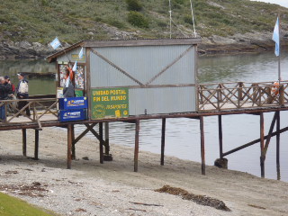 |
| The post office at the end of the world! |
This certainly was a beautiful
day around the southernmost city on earth.
Hello and thank you for the wonderful photos. As we were booked on your cruise for 18months before ill health put a hold on cruising, we appreciate seeing the voyage through your photos. Keep up the great shots. Lorri H.
ReplyDelete