Thursday, September 12, 2013

Transatlantic Cruise: Days 22-24: Seas Days and then Greenland

Day 23
Saturday, September 07

Saw our FIRST ICEBERG today. 


Out on deck again about 11 pm to see if the Northern Lights are dancing around.  We tend to watch for the astronomer who is on board as a lecturer.  Last night he came out on deck, looked up at the skies, and said “Doesn’t look promising tonight….so I’m going to bed!”  We quickly followed him back inside as there was no point in standing out in the cold.


Day 24
Sunday, September 08
Nanortalik, Greenland

We arrive in Greenland, which is the world’s largest island.  The center of the island is permanently covered with a blanket of ice that is two miles thick in some places. We think Iceland and Greenland should have their names reversed.
We tender into Nanortalik


 Nanortalik is Greenland’s most southerly town and lies in a scenic area consisting of some of Greenland’s most picturesque fjords, small woodlands, and steep mountainsides. This we could not see as there is fog and a slight mist in the air today.  When we dropped anchor in the harbor this morning, we were able to see some icebergs floating along and the town was visible from the ship.  The town’s name means the “place of polar bears”, which refers to the polar bears that occasionally pass by the town in the summer in conjunction with the field ice from the Arctic Ocean.


The people of Greenland are of Inuit (or Eskimo) descent.  The primary language is Greenlandic (East Inuit), but Danish and English are also taught in the schools.

Based on the buildings and homes we saw, Nanortalik is not very well off; a lot of the homes looked to be only one room, or maybe 2-3 rooms in one of many multi-family “row houses”, though still colorful if somewhat dilapidated.


Nanortalik has only 1,400 inhabitants and is visited by relatively few tourists each year.  With only a limited number of local guides available, there were no organized ship tours.  Instead the townspeople offered performances of folk singing and dancing.    The sports center where they were held could accommodate a large number of people throughout the day.


I think we are going in the right direction.


We found our way to the sports center and welcomed getting out of the heavy mist that was now coming down.  Coffee and cake were offered to us as we sat at tables to wait the start of the performances. 
 
I think that says "Sports Center"
The Kaffe-mik (coffee party) is an old tradition where a family invites many guests into their home in celebration of weddings, birthdays, etc.  Coffee or tea and Greenlandic cake is served.  The cake was more like a sweet bread.

The Greenland flag

We were in the sports center for the first round of performances.  It included the church choir, singing in their native language and then folk dances performed by the children in town.


One lady slipped in late, but she did have on the native clothes


When the repeat round of performances were about to start, we left the building and simply walked around the town a bit.  Our destination was to the church for a photo and then the Visitor Center to buy a post card to mail our grandson from Greenland.


With that being accomplished, we joined the line to tender back to the ship so we could get warmed up and dry.  The temperature today was a chilly 41 degrees and we had had enough.


The local kids interacting with us tourists.
We’re happy we made it Greenland; it is a port that is often skipped due to inclement weather conditions.  Had we better weather, our afternoon activity would have been a hike up the mountain behind the town for views of the Nanortalik and Tasermiut Fjord.

Wednesday, September 11, 2013

Transatlantic Cruise: Day 21--Reykjavik, Iceland

Thursday, September 05

Iceland is a land of volcanoes and glaciers, lava fields and green pastures, boiling thermal springs and ice-cold rivers. The first humans to visit here appear to have been Irish monks, looking for solitude during the ninth century.  Soon afterward, Vikings from Norway discovered Iceland and began to arrive in large numbers.  Think Leif Erickson, who we all know is the one who discovered North America a few hundred years before that Columbus guy!  The northernmost capital in the world, Reykjavik was founded in 874 when Ingolfur Arnarson built his farm on the peninsula where Reykjavik stands today.

Reykjavik is by far the largest community in Iceland, with a population of about 200,000, which is about 60% of Iceland’s total population of 300,000 people.

Our tour today is called the Golden Circle Tour.   This is Iceland’s most popular day trip out of the Reykjavik port as it covers geysers, waterfalls, lakes, and volcanoes.  The Iceland Horizons tour company van met our group of 14 cruise critic roll call members at the port and off we went, along with many cruise ship buses.  I’m afraid all 3,000 passengers aboard the Caribbean Princess are headed to the same places today!


Our first stop was to Thingvellir National Park.  It is a geological wonderland with rock formations and a beautiful river and Iceland’s largest natural lake.  The water in this lake comes from the ice field.  We were told that it takes 25 years to make its way underground from the icefield to the lake—the water is pristine clear.  This area is the historic meeting place of the Icelandic Vikings who developed the first parliament in Europe as early as 930 AD.  Each tribe chose a chieftain and 38 of these local chieftains met at this site 2 weeks each year to discuss common concerns, elect leadership and decide policy.

When we pulled into the parking lot, hordes of people had already left the tour buses and it was very crowded as we snaked our way around everyone to see the view and take a photo.  But it was a most beautiful site.


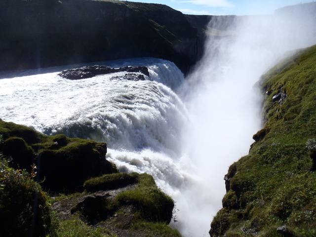
Our next stop was at Gullfoss Waterfall:  Glacial water is brownish, since it carries lots of sediments that the glacial ice has carved off the earth. Gullfoss is called the "Golden Falls", since on a sunny day the water plunging down the three-step staircase and then tumbling in two steps down into the deep crevice truly looks golden. As the story goes it's thanks to Sigríður Tómasdóttir that we can enjoy the beauty of Gullfoss, because she was the one that protested so intensely against the plans for a hydroelectric power plant at the site of the falls by going as far as to threaten that she would throw herself into Gullfoss and thereby kill herself.


To make her threat believable she went barefoot on a protest march from Gullfoss to Reykjavik on unpaved roads and when she arrived after 24 miles her feet were bleeding and she was in very bad shape.

The people believed her and listened and the powerplant at Gullfoss was never built.

Next stop was at the geysers.  One geyser would pop up about every 10 minutes or so.  I was able to catch it blowing up its steam.  Looks like some people like to get up really close to the falling hot, steamy water.


We had time to wander through the gift shop. Very, very expensive!  Not unusual to see items listed for 22,900 kroner.  (About $200USD)  A stocking hat we liked was $57USD.  It remained in the gift shop.


Our driver/guide had a couple other stops in mind for us before we headed back to Reykjavik.  First one was another waterfall, that he called a mini Niagara Falls.  And we were the ONLY ones there!


A salmon ladder on the left of the falls.

Then he said he would show us where some people may go when they die…..what??  He drove into a mining area that was all red rock and said “welcome to hell”.  I didn’t catch what kind of mining this was.


We passed a point in the river where the water from the falls, which is murky due to picking up minerals along the way, meets the water from the lake that we saw in the morning in the Thingvellir National Park, which comes from the icefield underground and is very clear.  We definitely could see the two different waters.


Back in Reykjavik we saw a few sites in the city before being dropped off at the ship.  Again, we had a wonderful day in Iceland.  We were so lucky that we had 3 days of sunshine.  The locals told us that the weather for the previous month had been rain and fog every day.

 
My favorite T-shirt 

Tuesday, September 10, 2013

Transatlantic Cruise: Day 20--Isafjordur, Iceland

Wednesday, September 04

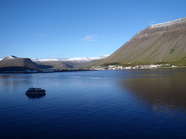
Isafjordur, Iceland (population 3,500) formerly one of Iceland's main trading posts, was granted municipal status in 1886. Some of Iceland's oldest and best-preserved buildings, dating from the 18th century, are located in Ísafjördur. The town is still predominantly a fishing center. Mountains surround Ísafjördur on the three sides and the sea on the other.


The main street here had quite a number of little shops and cafes, as well as the local main store (food, pharmacy, sundries, a few clothing items, etc). We’d heard in the port talk that the sweaters were very very expensive (hundreds of dollars), as they have been in Norway and Iceland. The Icelandic kroner being 120 ISK to each US Dollar, $100 US would be 12,000 kroner and sweaters are usually marked in the 25,000 kroner range.


Our plan today was to walk around the town, which took about 15 minutes, and then inquire in the Visitor Center about a hike up onto the mountain behind the town.  We were told of two possibilities:  one would simply be straight up the mountain from the street outside the Visitor Center for a short hike; the other would be a hike alongside the harbor and then up the mountain to a waterfall.  Did we hear waterfall?  That was an easy decision and we had all day.
We think this would be the barber shop

This homeowner has a sense of humor


Statue in honor of fishermen

So off we went on what we were told would be a 10k (just over 6 miles) hike.  Along the waterfront road we met about 50 kids on bikes. School was in session and this was probably their morning exercise.


Soon we reached the waterfall and we knew we had picked the right hike.  It looked wonderful! Half a dozen photos later we are on our way up the mountainside.  


A "selfie"

A small dirt trail led us right alongside the stream coming from the waterfall.  Soon we were climbing, and I do mean climbing, up the steep slope.  It was wet and slippery in spots, with the 8-inch wide trail covered with thicket.  There is no fencing to keep us from slipping and going into the water.  We are grabbing on to the branches of the thicket shrubs to steady our climb and Terry is holding on to my arm to help me with the climb.  The only thing that keeps me going on up the mountainside is the belief that going back down would be even harder.
 
This would be the name of the waterfall

Ahh, Terry, we're no where near the top.

This is what our trail that we followed looked like.


Ahhhh, but we are not there yet.

This is only about half way up

It was quite the climb but we finally reached the top.  After enjoying the view from the top with a granola bar and water break, we stepped on to the plateau above the falls and saw a road in the distance.  It was just a matter of traversing the rocky terrain that is covered with little streams of water winding all over the place and we triumphantly reached the road.  It will be so much easier getting back down into the town now.
Getting close to the top.


A look down from close to the top

Almost there
 
The last few steps

Finally, the plateau at the top and we head for the road

We met a couple of people hiking up the road and a local lady picking berries.  She said they were blueberries and very, very sweet!


Alongside the road were these mounds of dirt that were obviously man-made.  A sign nearby explained that these are part of the Avalanche Defense System.  With the water running all over the sides of the mountain, the rocks are loosened and avalanches do occur.  To prevent rocks from sliding all the way down into the houses along the harbor, these small man-made mounds will hopefully keep the town safe.


Back on the ship, our second port in Iceland was declared a success.  We did have a fun….and memorable hike….and the weather has been perfect!


On the tender boat heading to the ship

Our hiking map

One more port in Iceland….next is Reykjavik.